Laredo is one of the fastest-growing cities in Texas.
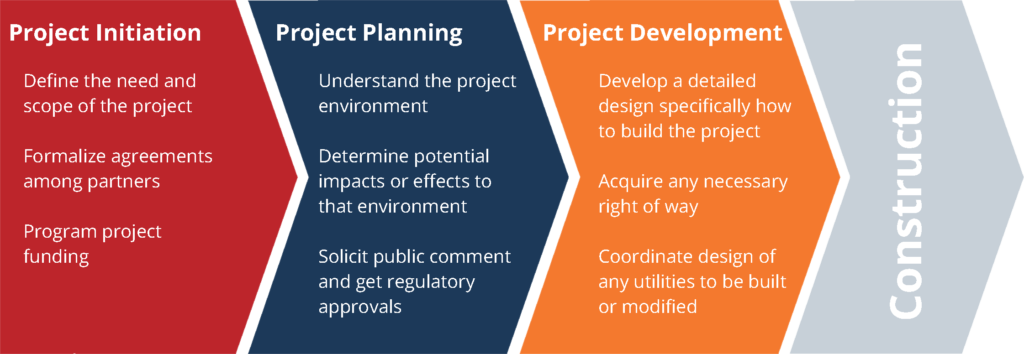
Over the past ten years, there has been a steady increase in population, employment, and economic growth. To plan for this growth, the Webb County-City of Laredo Regional Mobility Authority conducted the North Laredo-Webb County Transportation Planning Study to assess mobility conditions, gather community input, and develop transportation solutions.
Goals of the Study
- Identify roadway improvement projects to relieve congestion in North Laredo
- Promote safety for all users of the transportation network
- Coordinate planning and implementation efforts with International Bridge and Port of Entry operations
- Coordinate private land development and public investments in mobility infrastructure
- Promote efficient movement of goods while reducing the impacts of freight operations on neighborhoods and sensitive lands
- Improve overall transportation network connectivity and resiliency
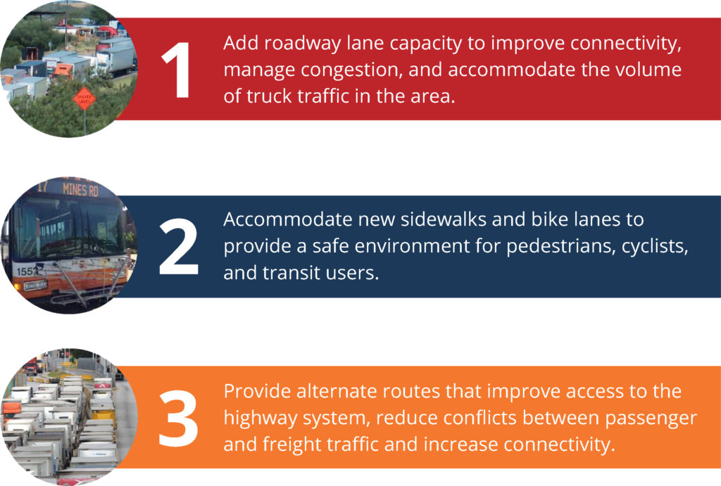
The study recommends three improvement areas for the transportation network in North Laredo and Webb County
Improvements were developed using traffic analysis and stakeholder input
Traffic patterns in the study area provided critical information about the effectiveness of a roadway and its given cross-section within the overall network. This information was used to confirm appropriate cross-sections, then used to analyze various combinations of roadway improvements to evaluate impacts and benefits to the overall network in the base year 2018 and the future year 2040. This was done using the latest available regional travel demand model from the MPO. The traffic analysis compared performance related to the overall network as well as how proposed improvements affected individual roadways in the system. This information was then used to develop and test improvement strategies. One of the most important sources of input to the study was the public and key stakeholders, who played a critical role in establishing study goals, vetting potential roadway network solutions, and giving feedback on priorities.
Recommended Roadway Network Improvements
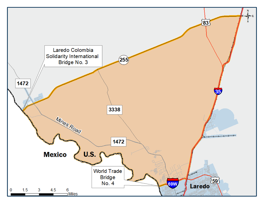
One of the biggest challenges in the study area is a general lack of roadway infrastructure that places an increased burden on existing roads, particularly FM 1472 (Mines Road). The study reinforced the need for added capacity on existing corridors, as well as providing new roads in the short, mid, and long-term to improve connectivity, and system performance.
Recommended Multimodal Improvements
The study area is also unique in that it has both residential and commercial uses in very close proximity. To better support these mixed uses, the study proposes several multimodal improvements to help provide a safer environment for pedestrians and cyclists. Depending on the location within the project area improvements could include protected bike lanes and/or shared-use paths, improved pedestrian lighting, and connectivity across the interstates and through interchanges.